|
This file is available on a Cryptome DVD offered by Cryptome. Donate $25 for a DVD of the Cryptome 10-year archives of 35,000 files from June 1996 to June 2006 (~3.5 GB). Click Paypal or mail check/MO made out to John Young, 251 West 89th Street, New York, NY 10024. Archives include all files of cryptome.org, cryptome2.org, jya.com, cartome.org, eyeball-series.org and iraq-kill-maim.org. Cryptome offers with the Cryptome DVD an INSCOM DVD of about 18,000 pages of counter-intelligence dossiers declassified by the US Army Information and Security Command, dating from 1945 to 1985. No additional contribution required -- $25 for both. The DVDs will be sent anywhere worldwide without extra cost. | |||
11 September 2005
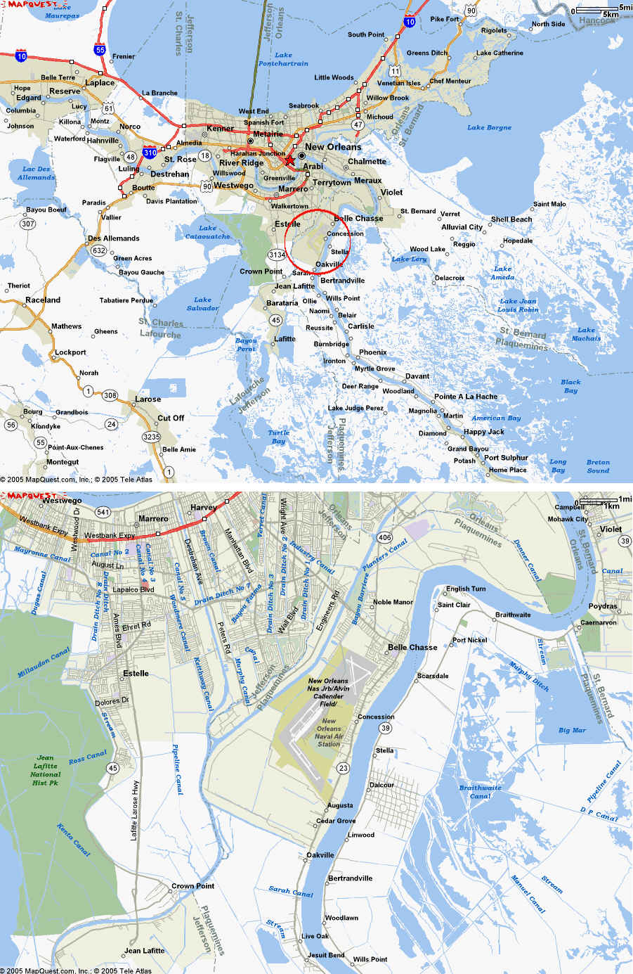
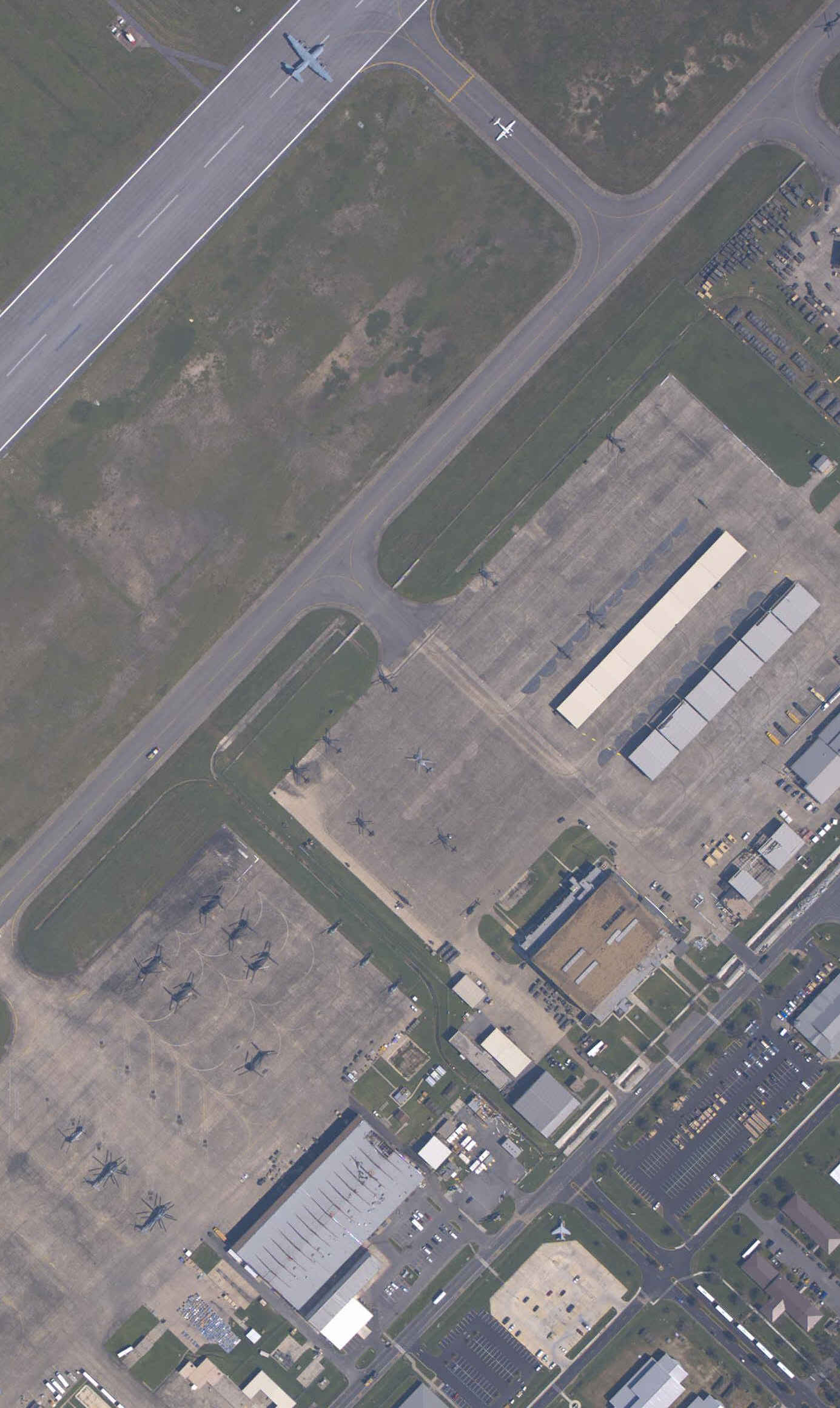
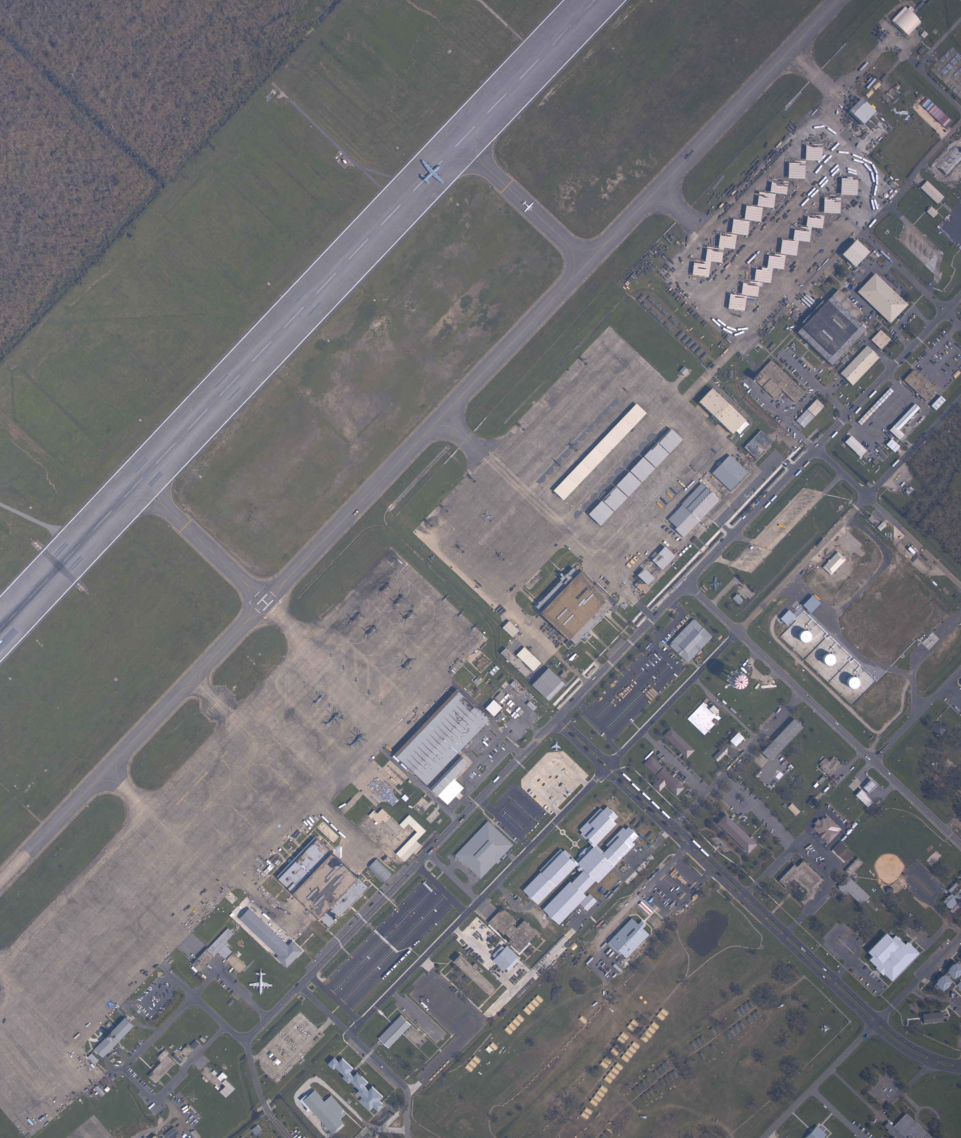
New Orleans Naval Air Station Joint Reserve Base (Alvin Callender Field), New Orleans, Louisiana, USA
http://www.airnav.com/airport/KNBG
Google satellite image, c. 2002:
http://maps.google.com/maps?q=29.8311,-90.0121&ll=29.830816,-90.014935&spn=0.054042,0.077707&t=k&hl=en
|
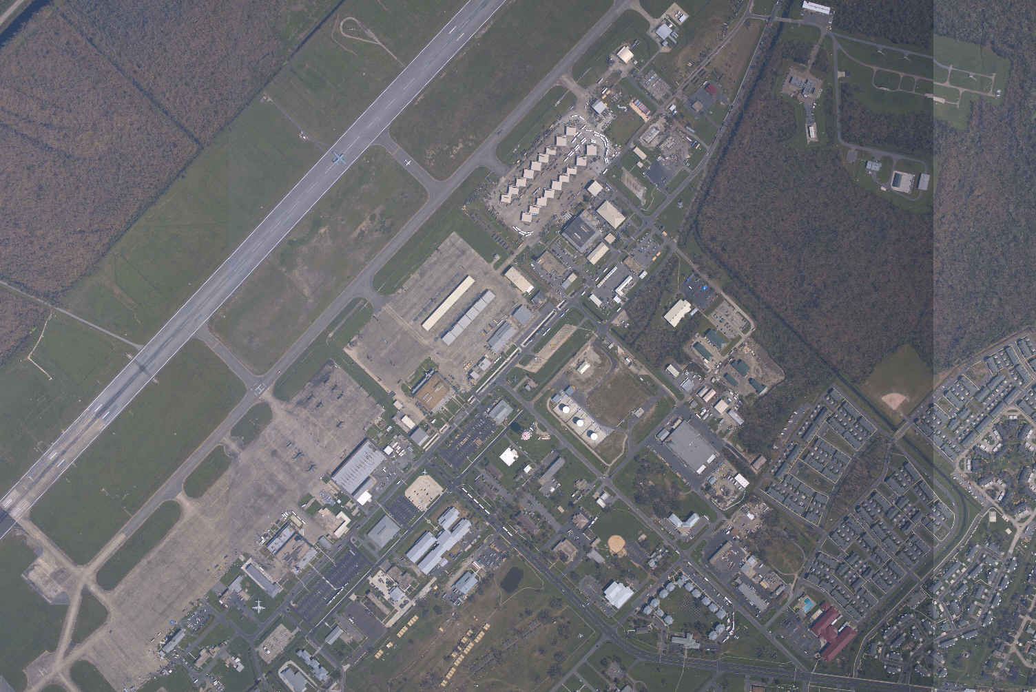
Composite of five NOAA aerial images taken September 9, 2005,
reduced to 25%.
http://ngs.woc.noaa.gov/storms/katrina/25215748.jpg (Note: North is to the right in NOAA images, these have been rotated 90-degrees counterclockwise.)
|
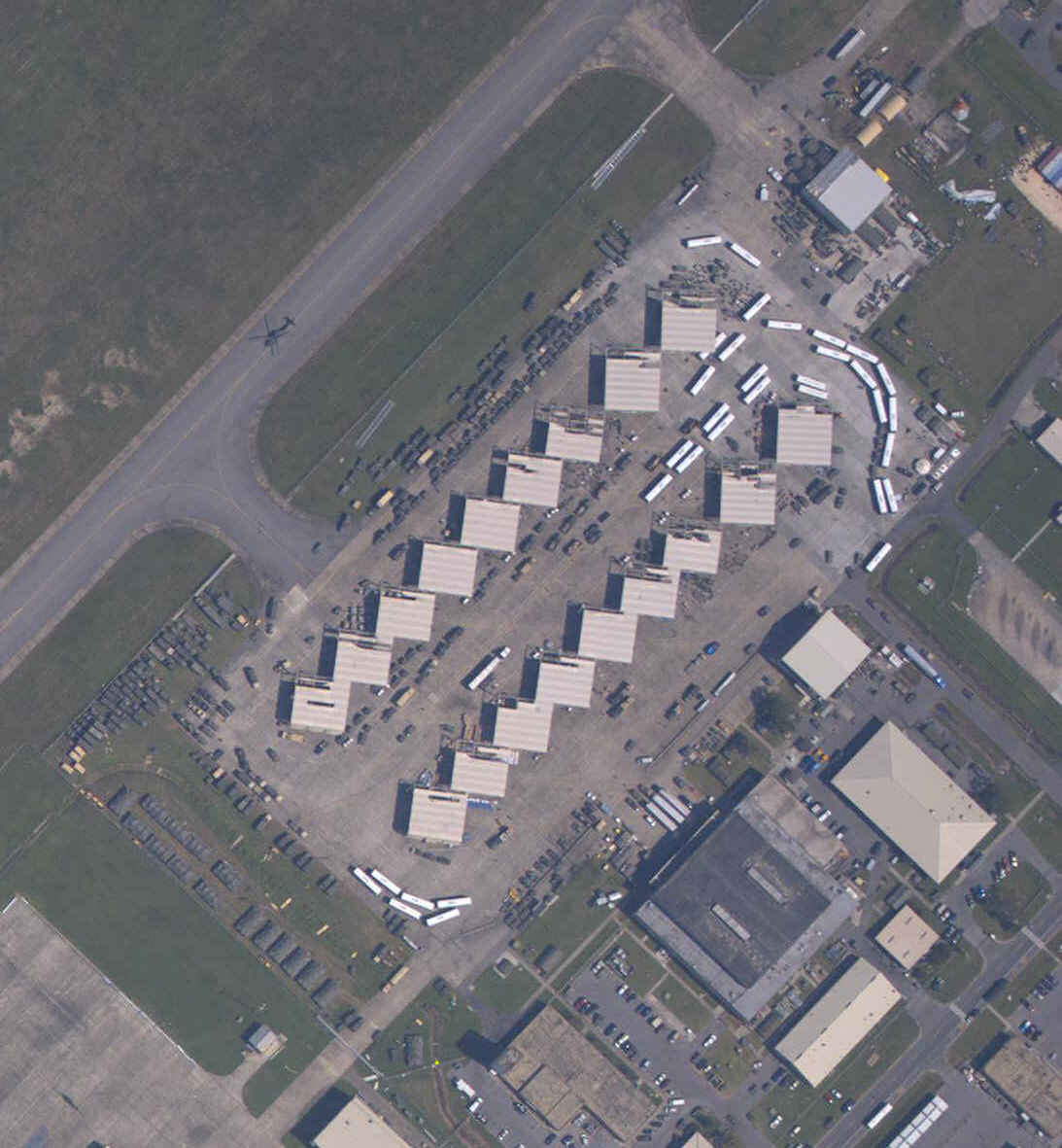
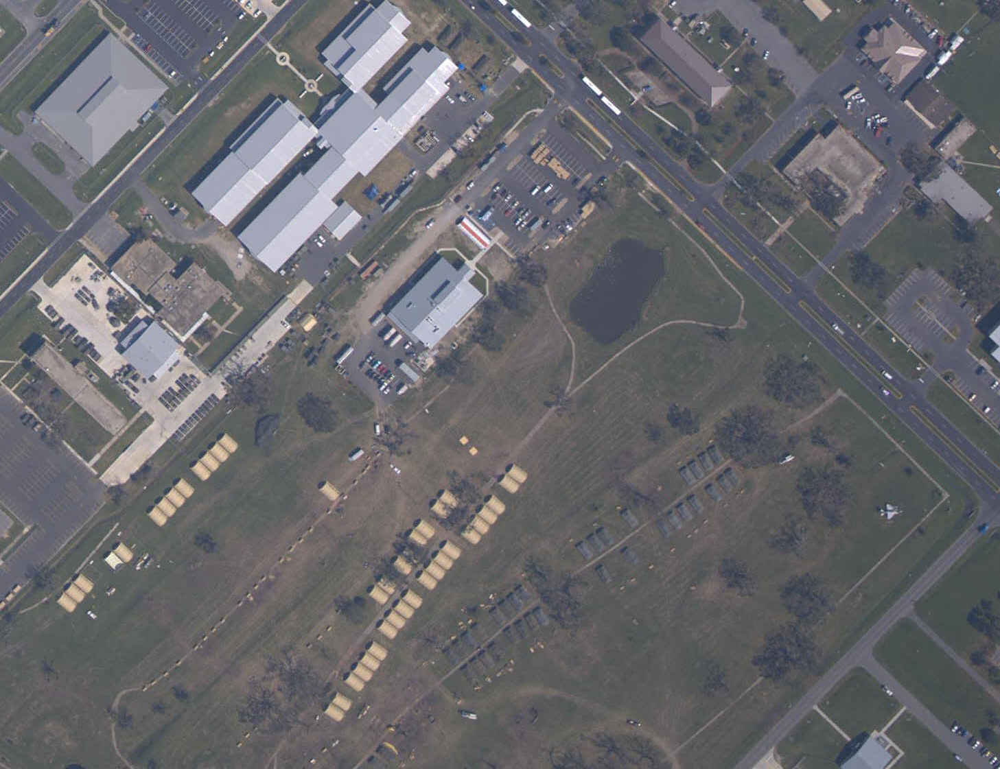
| Following images are excerpted from full-size NOAA aerial image taken September 9, 2005 (copy below) |
| Transportation Staging
|
| Temporary Barracks
|
| Aircraft Operations
|
| NOAA aerial image taken September 9, 2005
http://ngs.woc.noaa.gov/storms/katrina/25215759.jpg 1.6MB
|