Eyeballing
the
High Hazard
Dams of
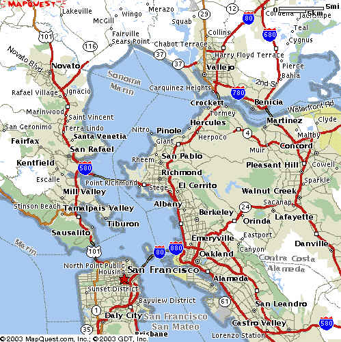
San Francisco
Bay
20 April 2003. One of the Eyeball
series.
Source of photos and maps: Mapquest.com
http://crunch.tec.army.mil/nid/webpages/nid.cfm
National Inventory of Dams Data Status
Introduction
With the National Dam Inspection Act (P.L. 92-367) of 1972, Congress authorized
the U.S. Army Corps of Engineers
(USACE) to inventory dams located in the United States. The Water Resources
Development Act of 1986 (P.L 99-662) authorized USACE to maintain and
periodically publish an updated National Inventory of Dams (NID). The Water
Resources Development Act of 1996 (P.L. 104-303), Section 215, re-authorized
periodic update of the NID by USACE, and continued a funding mechanism.
The current NID is the result of this evolutionary process. The USACE continues
to work closely with the Association
of State Dam Safety Officials (ASDSO),
FEMA, and other state and federal agencies
to update and publish the NID. The success of the NID maintenance and publication
program can be attributed to the cooperative participation of the 50 states
and Puerto Rico (as facilitated by ASDSO), and 17 federal agencies, who provide
information on approximately 77,000 dams currently in the NID.
The Interagency Committee on Dam Safety (ICODS) created a subcommitee to
advise USACE on the update o f the NID. The NID Subcommittee provides guidance
and recommendations concerning the data elements, format, and publication
media for the NID. Its membership consists of representatives of non-federal
and federal agencies who participate in the NID.
A web-enabled version of the 1998-1999 NID update was posted to the Internet
in January 1999. For this update, nineteen new fields of information were
added to the NID. This new information is necessary to assess dam
characteristics, and more effectively and appropriately allocate federal
resources for dam safety programs. The addition of these fields in the NID
required eight new fields in the states' National Inventory of Dams Data
(NATDAM) input file for incorporation into the NID (federal agencies must
submit an additional eleven fields in their databases). Participants are
continuing to work to improve completeness and accuracy for all data fields
in the NID. Updated data received by USACE is posted quarterly to the on-line
database.
The Corps of Engineers and ASDSO are continuously improving the process of
inventory data collection and transmission by the states and federal agencies
to take advantage of current PC computers, software and the Internet. Software
tools have been recently developed to improve the process of managing, inputting,
and transmitting NID data. User training for the states and federal agencies
on these software tools is starting in March 2001.
Note that the objectives of the program to update the NID are the same as
those stated in the 1989 manual ASDSO National Inventory of Dams
Methodology:
Points of Contact:
Technical Assistance:
U.S. Army Topographic Engineering Center
CEERD-TR-A, ATTN: National Inventory of Dams
7701 Telegraph Rd.
Alexandria, VA 22315
rd1@tec.army.mil
General Dam Information:
Association of State Dam Safety Officials
450 Old Vine Street, 2nd Floor
Lexington, KY 40507
info@damsafety.org
National Inventory of Dams Inclusion Criteria
A dam is included in the National Inventory of Dams if:
1) It is a High or Significant hazard potential class dam or,2) It is a Low Hazard potential class dam that exceeds 25 feet in height AND 15 acre-feet storage or,
3) It is a Low Hazard potential class dam that exceeds 50 acre-feet storage AND 6 feet height.
For defintions of hazard, please use data dictionary:
Downstream Hazard PotentialCode indicating the potential hazard to the downstream area resulting from failure or misoperation of the dam or facilities:
L for Low;
S for Significant;
H for High.Definitions, as accepted by the Interagency Committee on Dam Safety, are as follows:
1. LOW HAZARD POTENTIAL -- Dams assigned the low hazard potential classification are those where failure or misoperation results in no probable loss of human life and low economic and/or environmental losses. Losses are principally limited to the owner’s property.
2. SIGNIFICANT HAZARD POTENTIAL -- Dams assigned the significant hazard potential classification are those dams where failure or misoperation results in no probable loss of human life but can cause economic loss, environment damage, disruption of lifeline facilities, or impact other concerns. Significant hazard potential classification dams are often located in predominantly rural or agricultural areas but could be located in areas with population and significant infrastructure.
3. HIGH HAZARD POTENTIAL -- Dams assigned the high hazard potential classification are those where failure or misoperation will probably cause loss of human life.
|
|
 Alpine Lake |
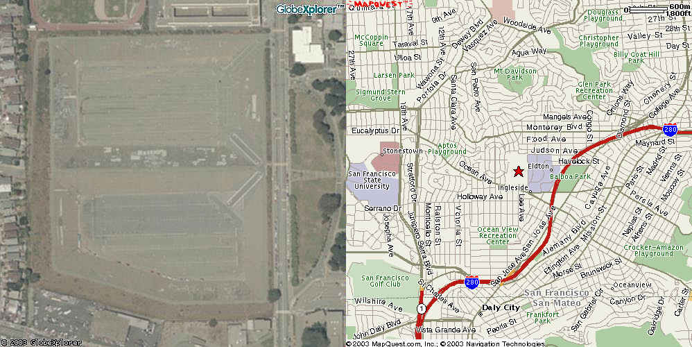
Balboa Reservoir (covered) |
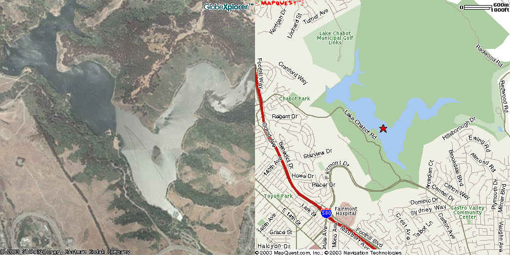 Lake Chabot |
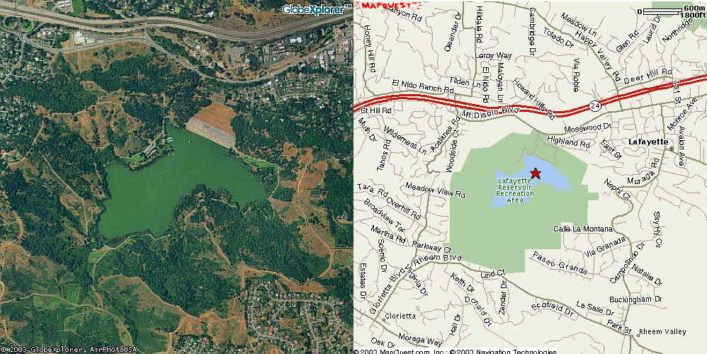
Lafayette Reservoir |
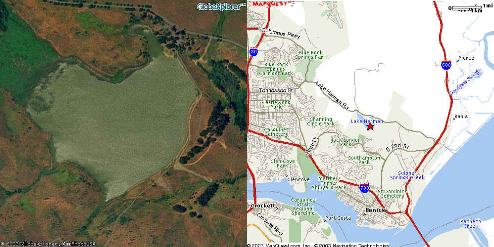
Lake Herman |
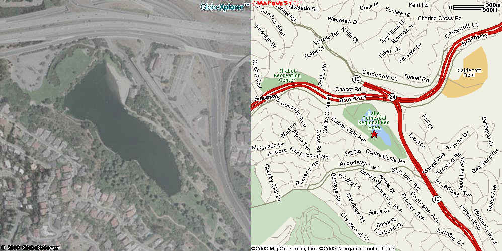
Lake Temescal |
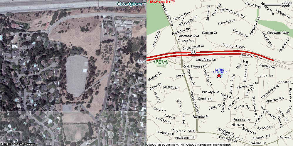
Leland Reservoir |
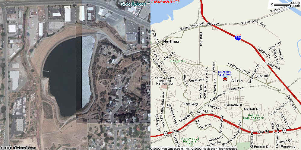
Martinez Reservoir |
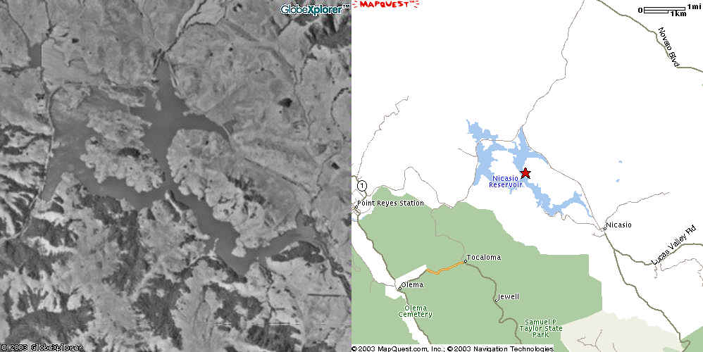
Nicasio Reservoir |
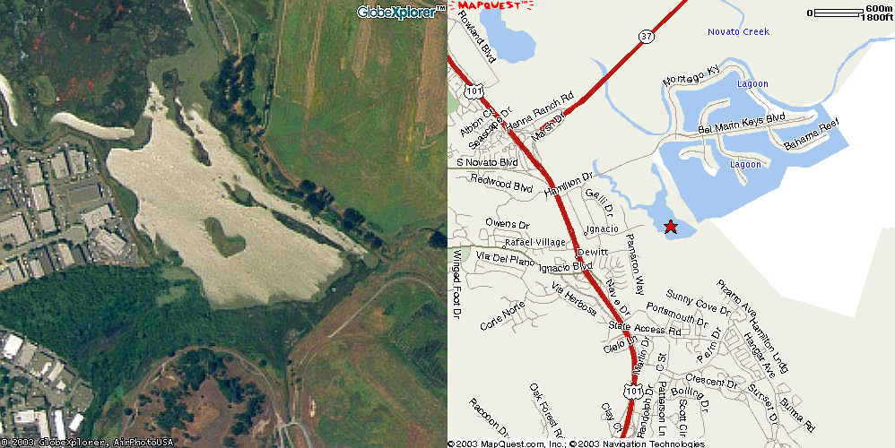
Novato Creek Reservoir |
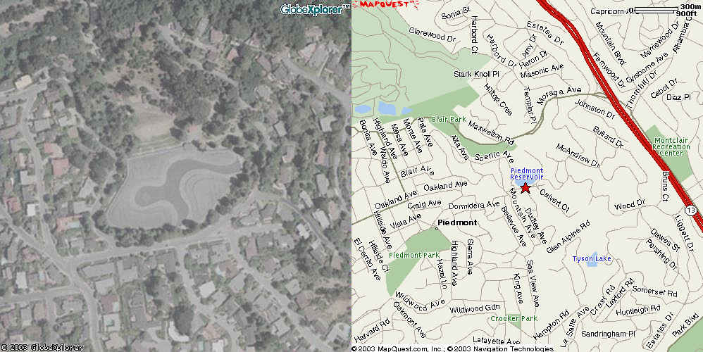
Piedmont Reservoir |
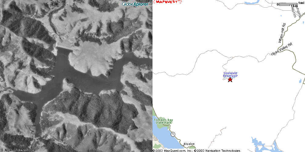
Soulajuie Reservoir |
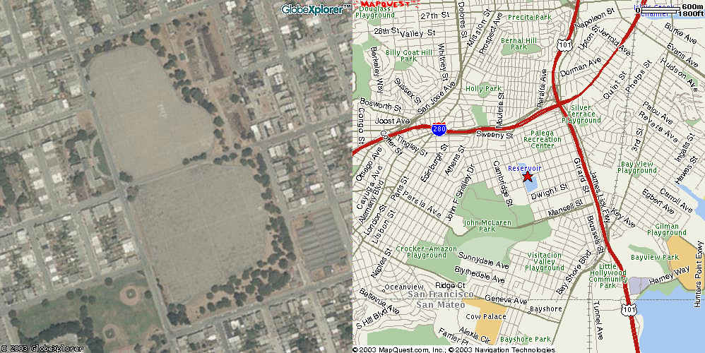
Stanford Heights Reservoir (covered) |
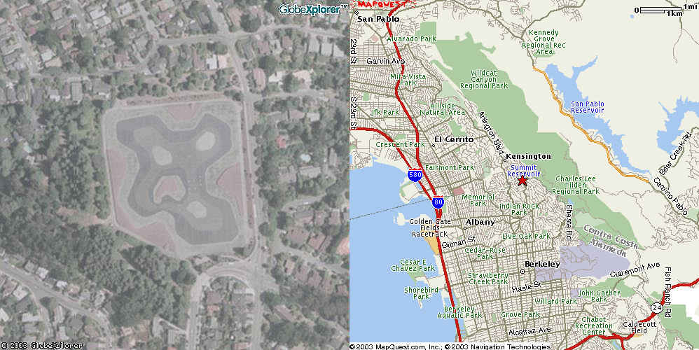
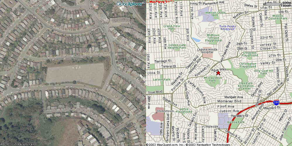
Summit Reservoir |
Sunset North Basin (covered0 |
Sutro Reservoir (covered) |
University Mound Basins (covered) |