Eyeballing
the
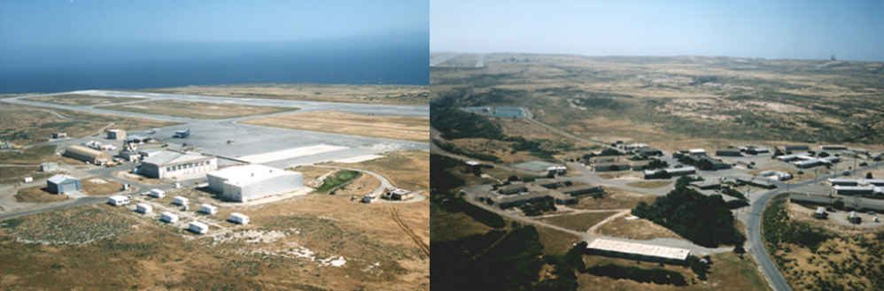
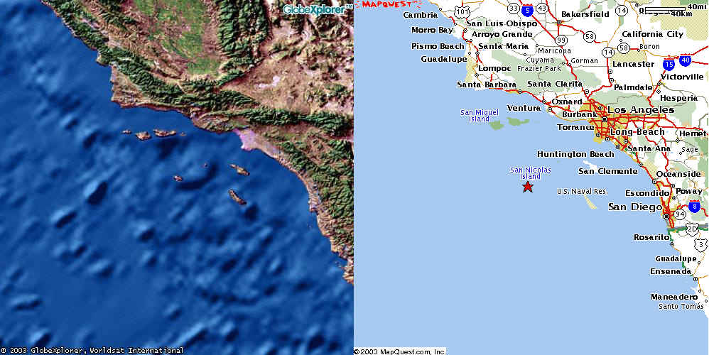
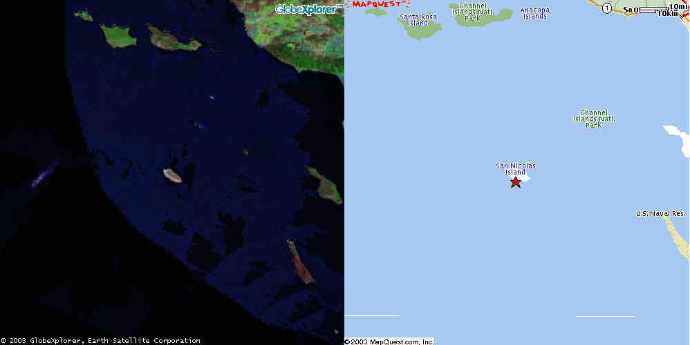
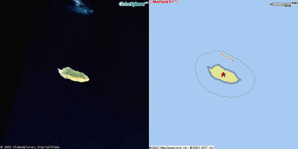
San Nicolas Island
Missile Test Center
![[Image]](snimtc-02.jpg)
Source
16 February 2003. One of the Eyeball
series.
Source: Mapquest.com
Hardcopy of the Washington Post, 16 February 2003 (based on a Los Angeles Times report of 20 January 2003):
[Excerpts]Missles and Foxes Share Remote Island
By David Kelly, Los Angeles Times
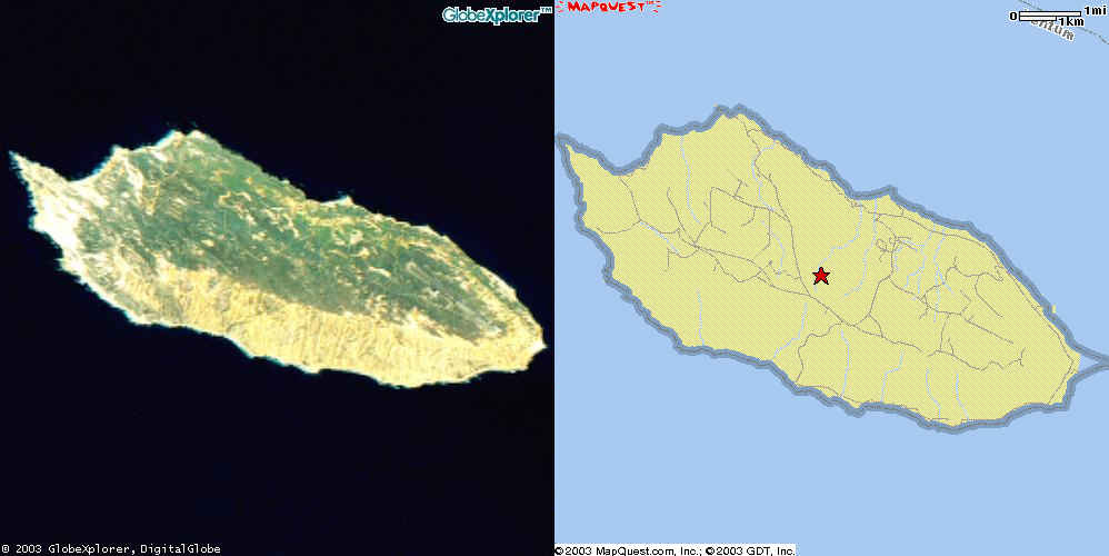
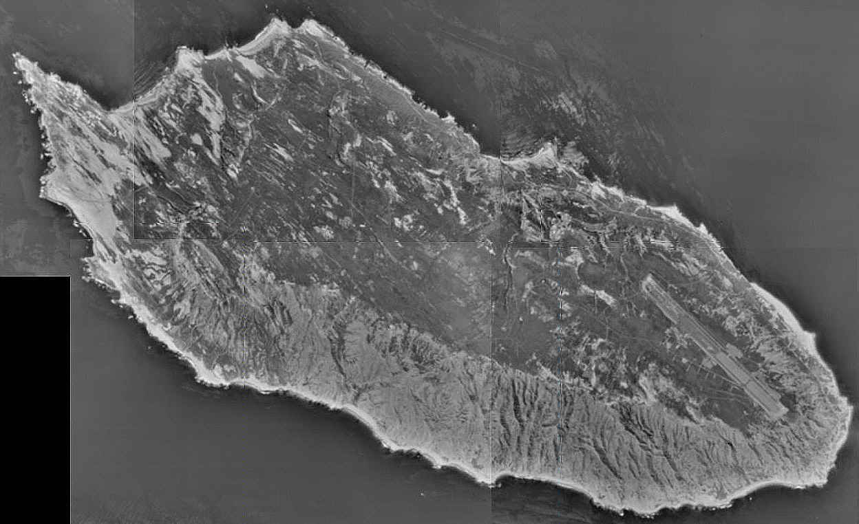
San Nicolas Island, Calif. -- Shrouded in secrecy, San Nicolas Island is a remote spit of land in a vast, shimmering sea. Some of the world's most sophisticated weapons are tested here, sometimes just a few hundred yards from where elephant seals trumpent in lagoons and island foxes trot through chapparal. Tomahawk, Harpoon, Sidewinders, and Sparrow Missiles routinely whiz overhead. Some skim in over the waves at 500 mph to clobber fake Scud launchers or dummy radar sites on shore. Because explosives are not used, workers dig the missiles out of sand dunes and use them again. Most of what happens on the island, about 75 miles southwest of Santa Monica, is top secret. The island, owned by the government since 1933, is a laboratory for the latest generation of weapons.
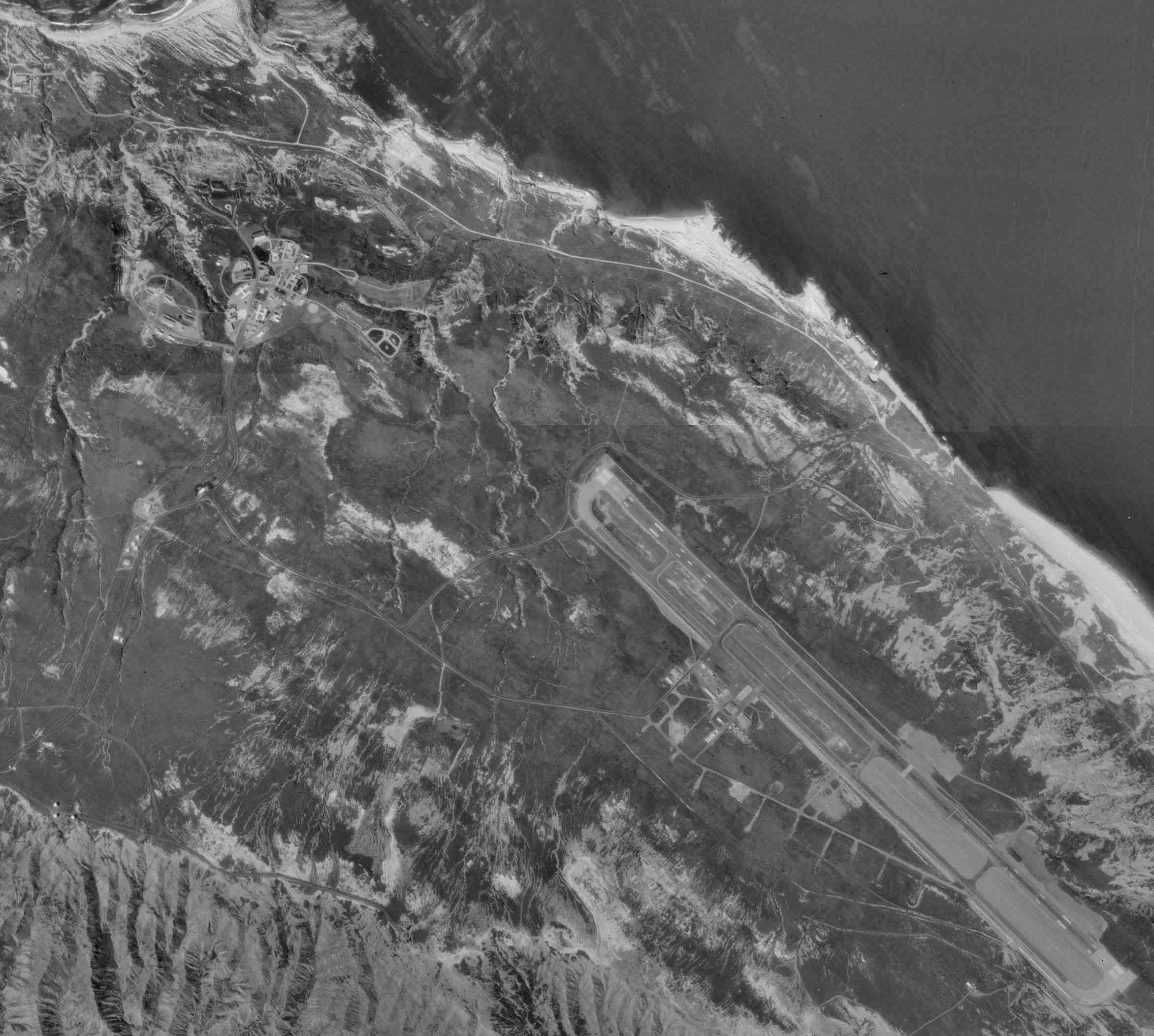
The testing area around San Nicolas is 36,000 square miles, enough air and ocean to accommodate the most powerful weapons. British, Norwegian, Japanese and Italian armed forces aften conduct secret tests in and around the island. San Nicolas is 10 miles long and three miles wide and has a 10,000-foot runway that can handle the largest aircraft. Sophisticated telemetry centers, shaped like enormous golf balls, dot the island, monitoring everything that flies overhead.
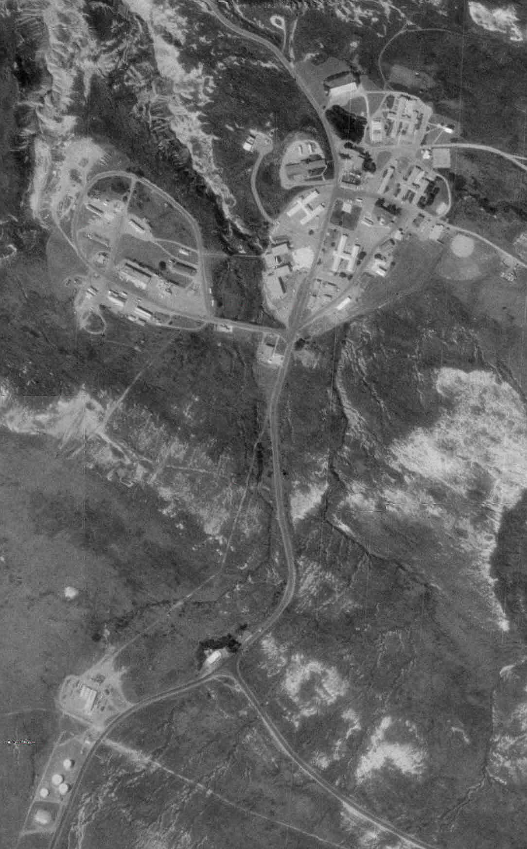
A small but heavily armed security force patrols San Nicolas, turning back curious boaters who try to land. The island's weekday population of about 150 military personnel and civilians drops to 30 on weekends. Home for most is Nicktown, a small cluster of low-slung buildings, including dormitories and a mess hall, a small store, a bowling alley and a saloon.
San Nicolas Island
http://www.nawcwpns.navy.mil/~pacrange/r1/Sea.htm
Naval Missile Test Photographs
http://www.nawcwpns.navy.mil/~pacrange/s1/photo/Sea.htm
San Nicolas Island Naval Outlying Field
San Nicolas Island, California, USA
http://www.airnav.com/airport/NSI
[Excerpts]FAA INFORMATION EFFECTIVE 23 JANUARY 2003
Location
FAA Identifier: NSI
Lat/Long: 33-14-23.210N / 119-27-29.481W; 33-14.38683N / 119-27.49135W
33.2397806 / -119.4581892 (estimated)Elevation: 504 ft. / 154 m (estimated)
Variation: 14E (2000)
Airport Operations
Airport use: Private use. Permission required prior to landing
Airport Communications
NAVY NICHOLAS TOWER: 126.85 374.8 [0700-1630 MON-FRI]
EMERG: 121.5 243.0
RDR: 126.85 134.1 308.4 345.2Runway Information
Runway 12/30
Dimensions: 10000 x 200 ft. / 3048 x 61 m
Surface: asphalt/concrete
Weight limitations:Single wheel: 76000 lbs
Double wheel: 99000 lbs
Double tandem: 148000 lbsRunway edge lights: high intensity
RUNWAY 12
RUNWAY 30Airport Ownership and Management from official FAA records
Ownership: U.S. Navy
Owner: US NAVY OCEANOGRAPHIC OFC - CODE 3142
WASHINGTON, DC 20373Additional Remarks
FLD SUBJECT TO CLOSURE WITHOUT PRIOR PMSN DUE TO DRONE MISSLE OPER.
|
Source |
 |
 |
 |
 |
 |
 |
 |
 |